
I'm super excited to announce that Open Source Surveillance has been finished, and today you can register and use it right now. 🚀🎉
You can read more about the tool and it's awesome capabilities in previous articles
 Wojciech
 Wojciech
 Wojciech
This article will present step by step tutorial for the tool and everyone who decide to register must read it first.
Screenshots presenting features of the tool
Also, watch cool promo video for the project
Most important things
- Credits are deduced only when, at least, one item has been found.
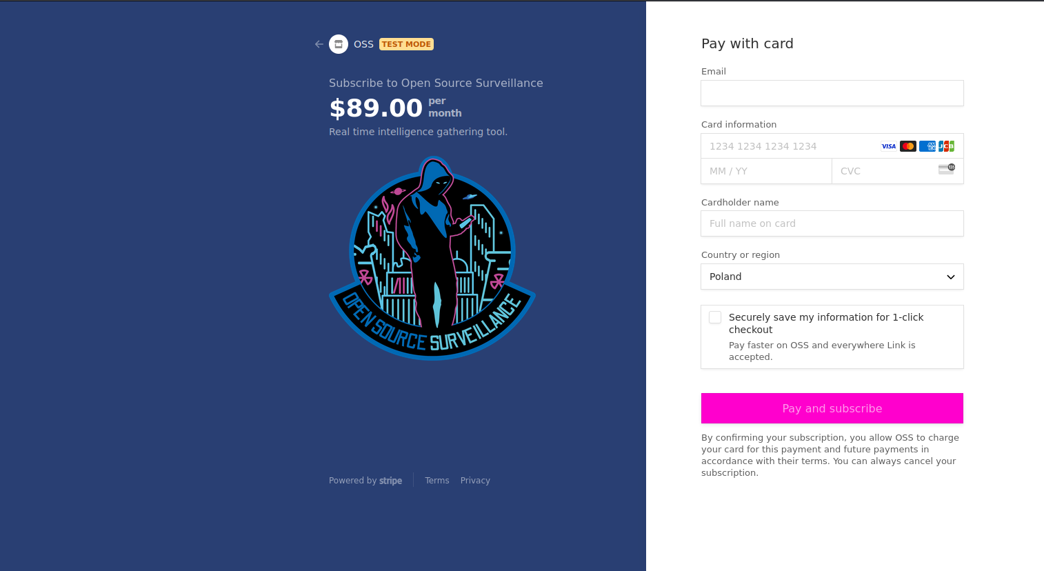
- You must use same email address to register to the app and for purchase via Stripe. It won't work if you provide different ones.
- By adding location you create a new, completely separate Workspace.
- If there are no findings, no information popup will be displayed.
- It searches for new items only, so if you search twice in same place there will be no results.
- Some modules work based on Radius and some based on Map Boundaries, list in "Modules" chapter.
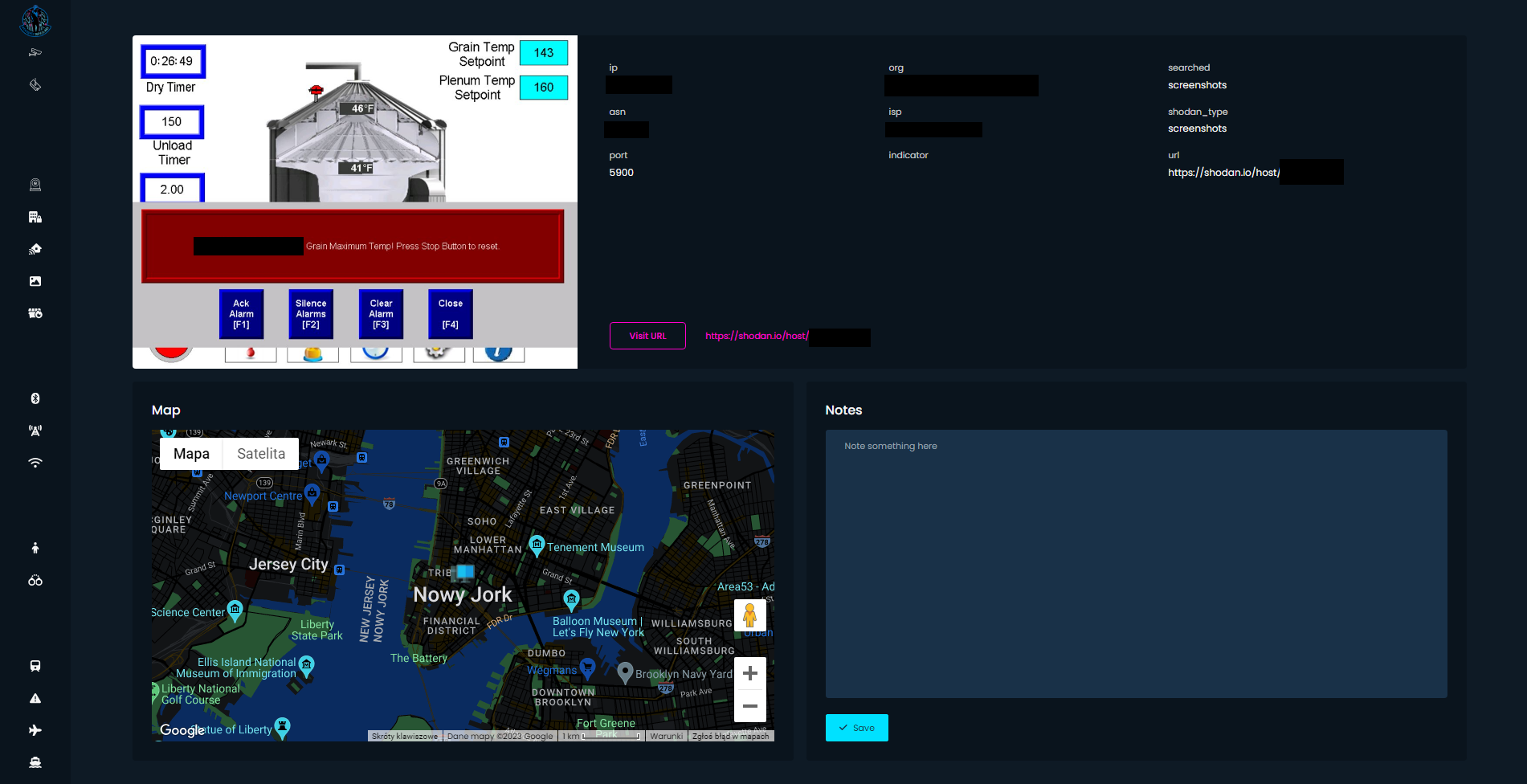
- Shodan module (Exposed Cameras, IoT, ICS, Vulnerabilities, Screenshots) is displayed on map only for illustration purposes. It's IP based geolocation, so it's not accurate at all. Read more how to geolocate such devices.
Wojciech
- Only first 100 results from Shodan modules are extracted
- "Show all" button displays all gathered items on the map, if there are hundreds of them it could take some time to render it all, but after that map will be ready to review.
- For Wigle (Bluetooth, Cell Towers, Wifi Networks) data points is taken into consideration rather than amount of requests. Each requests display 20 results, in Mini tier you have 250 and in Max 500.
- Not all modules are accurate, Snapchat and Weibo shows items in radius of 1 and 5 kilometres.
- Search multiple times putting marker in couple hundreds meters in different direction. Radius based APIs can find new items.
- Instagram Places and VK Photos can be accessed only by authenticated users, so you need to be logged in to your Instagram or VK account to review the links.
- It was not meant to work on mobile but after some time, you can get used to website behaviour and use it on your phone as well.
- Crimes & Amber Alerts and Traffic Cameras modules are available only in United States of America.
- Please report all issues and bugs via Discord channel or email address

- Data won't be deleted after your subscription expires.
- This is the minimal product. It will be developed and I have a plan to grow it over the next year.
- New subscription purchase will reset your counter of requests.
- More information on https://www.os-surveillance.io/tos
Tutorial
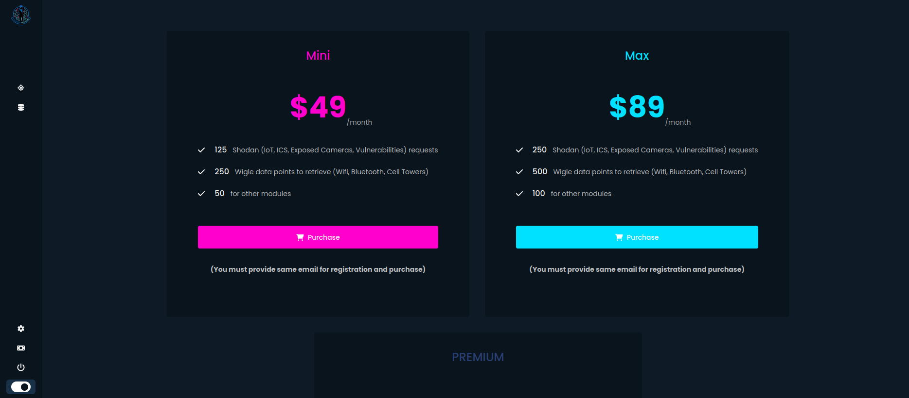
Purchase
- When you visit site for the first time after login you should see pricing table
Contact me for Unlimited Plan
- After clicking any button, you will be redirected to Stripe payments
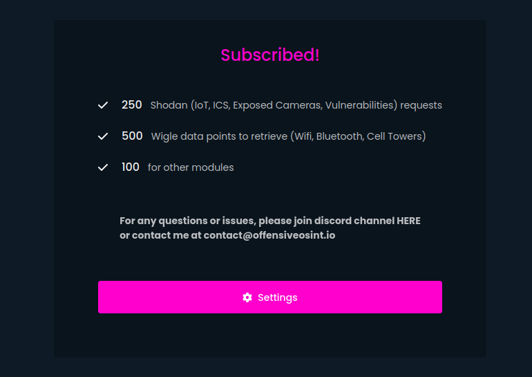
- After successful payment you will have full access and credits to use
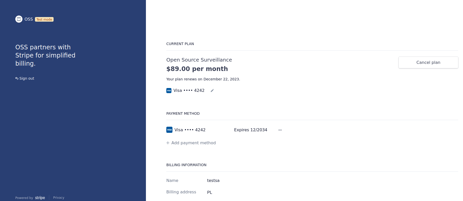
- You can manage subscription in Settings by clicking "Manage subscription". Then you need to provide same address as you used for registration and purchase to login to your customer panel where you can cancel subscription.
Application
Tutorial is embedded into the app when you run it for the first time, but I want to make some things clear.
- Main Screen
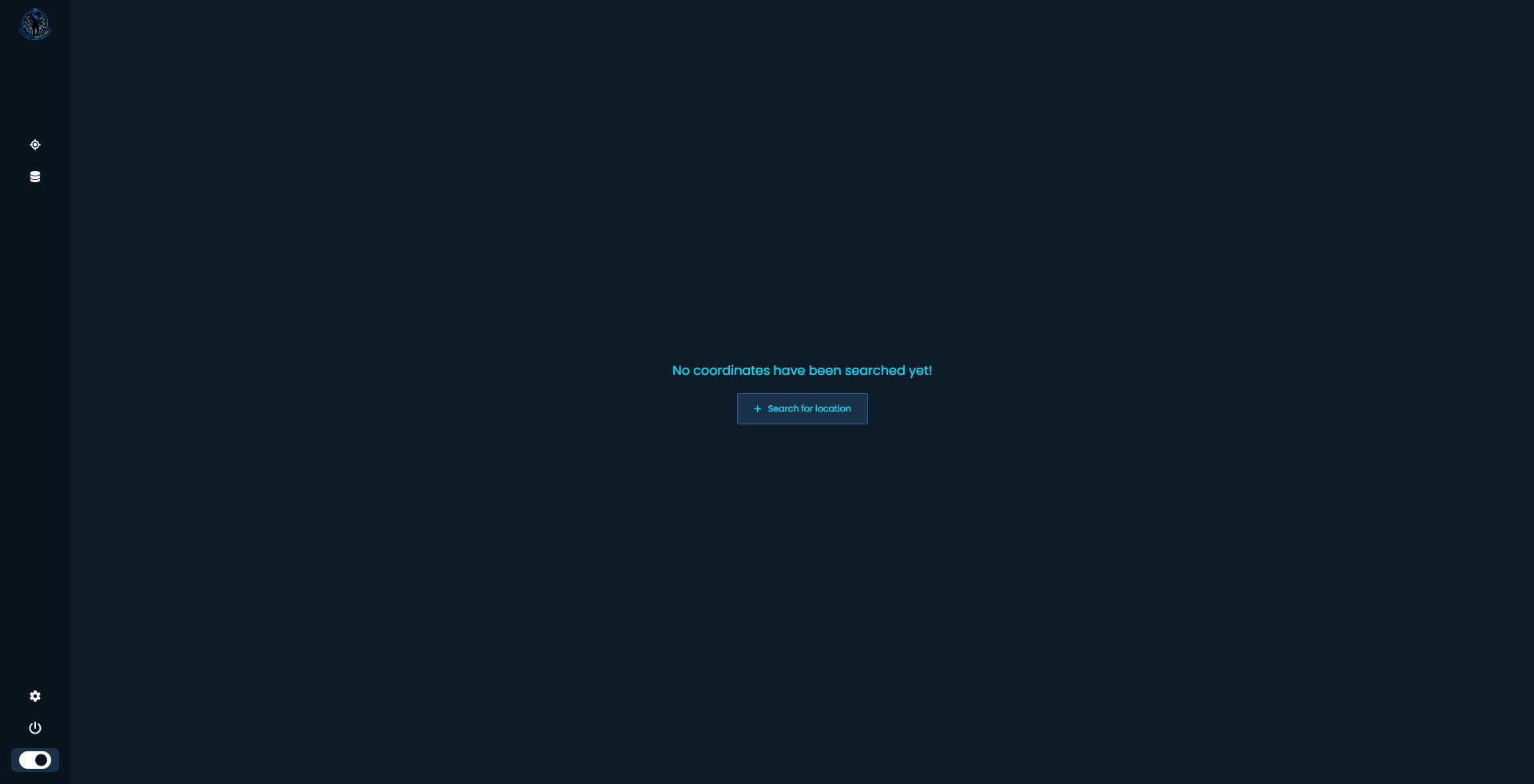
This is more or less the first screen you should see after login. It means there are no territory or Workspace in database. To add one, you need to click "Search for location" button or the crosshair icon on the left sidebar menu.
- Add Location

You will be welcomed with map where you need to put a marker on the place you want to investigate. Also you must give your investigation a name. You can search for a city or specific street at the top of the screen.
After you picked the place, click on "Add this area".
- Choose Location
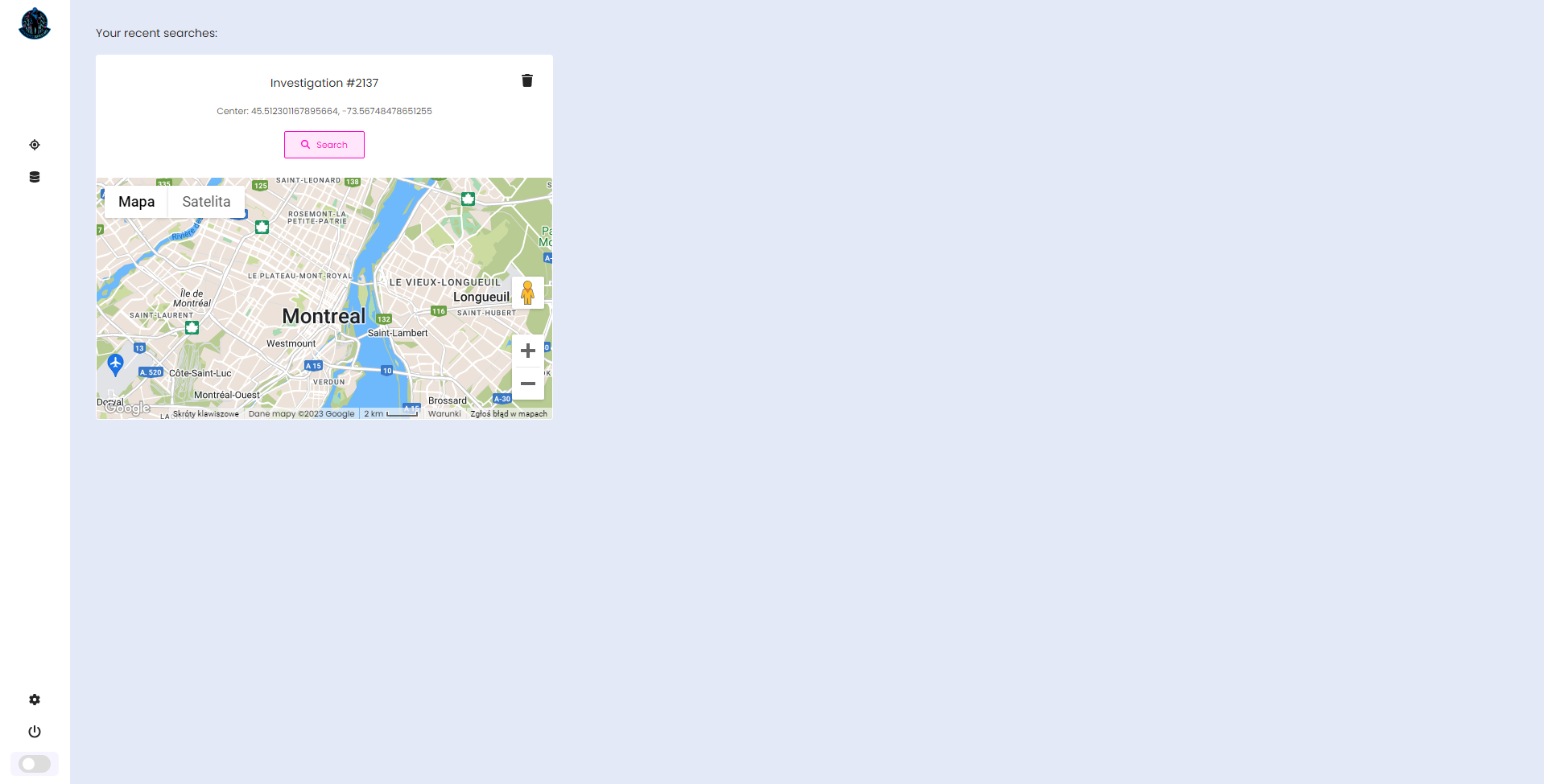
Right now you have your Coordinates in the database. This is the place you have chosen in the previous step.
If you want to access this territory click on "Search" button, if you want to delete it and all associated items, click on bin in the top right corner.
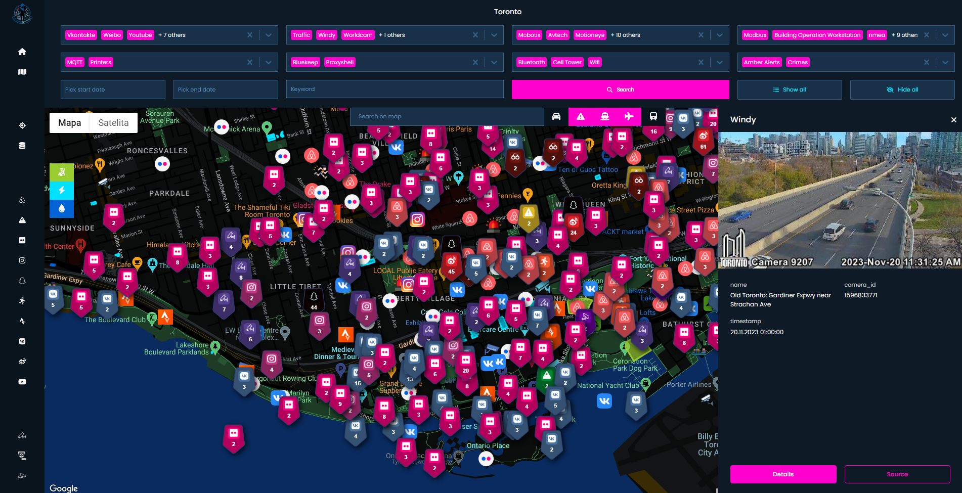
- Search
I put some colours on the screenshot to explain specific parts of the screen and how to use the application efficiently.
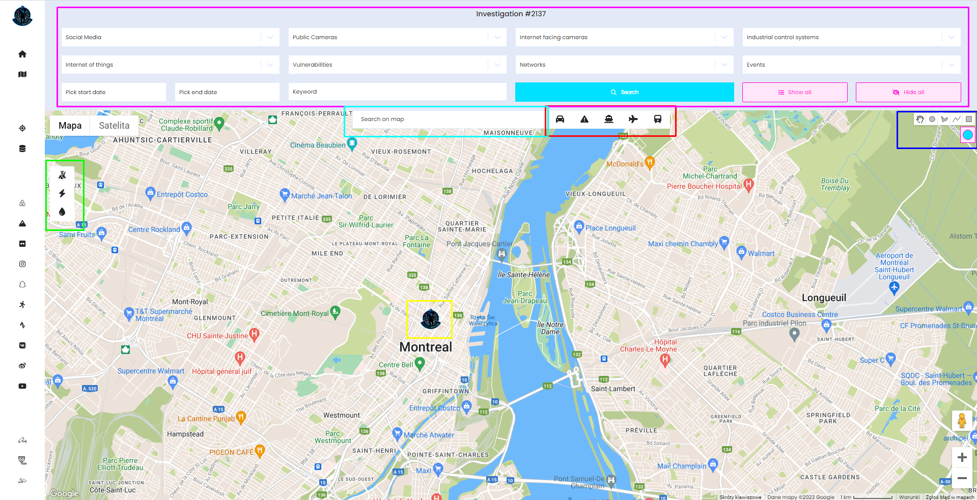
- Pink Box - Search box
Main Search box where you need to specify modules you want to run and/or date and keywords.
To scan click "Search" button. You can also hide and show all collected items, but be aware that it might take a while to render all items.
- Green Box (Left) - Critical infrastructure modules
First one is responsible for showing military facilities, middle one for Power facilities (power plants, substations) and last one is water related facilities like wastewater power plants
- Light Blue Box
Search for a place or street in current Workspace on the map
- Red Box - Transportation modules
From left - Road traffic, incidents, vessels, planes, Amtrak trains. All of them work on coordinates boundaries.
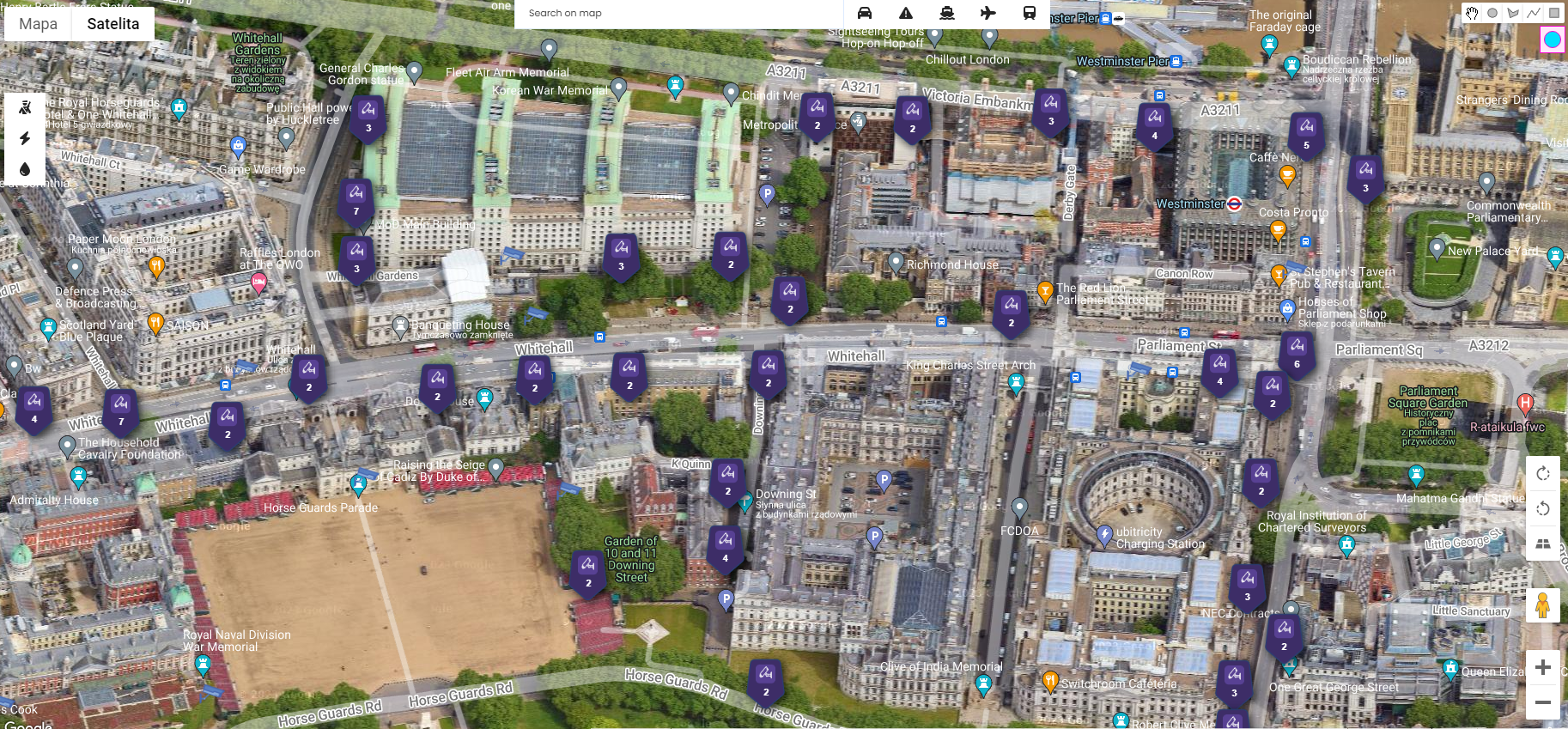
- Dark Blue Box - Drawing manager
Draw, on the map, different shapes with different colours
- Yellow - Marker
You must put the marker on the map before you start searching. This marker indicates initial location to scan for based on radius.
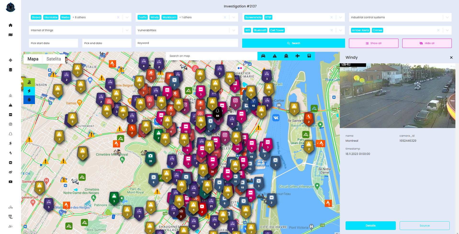
And below you can find example map after searching for majority of modules including critical infrastructure and transportation.
Modules
In version Mini, you have 50 requests per module, 125 for Shodan and 250 for Wigle (data points) and in tier Max - adequately 100, 250 and 500.
Here I want to explain all sources and how to properly use them to squeeze max out of the investigation. Important to note is that some modules work on radius and some on map boundaries. So it means you need to zoom in or zoom out to get results in given range. It's best to zoom in as max as possible and searching by zooming out one step, then you know you won't miss anything.
R stands for Radius, B for boundaries
- Social Media
- Airbnb (B)
- Alltrails (B)
- Flickr (R)
- Instagram (R)
- Snapchat (R)
- Sportstracker (B)
- Strava (B)
- Vkontakte (R)
- Weibo (R)
- Youtube (R)
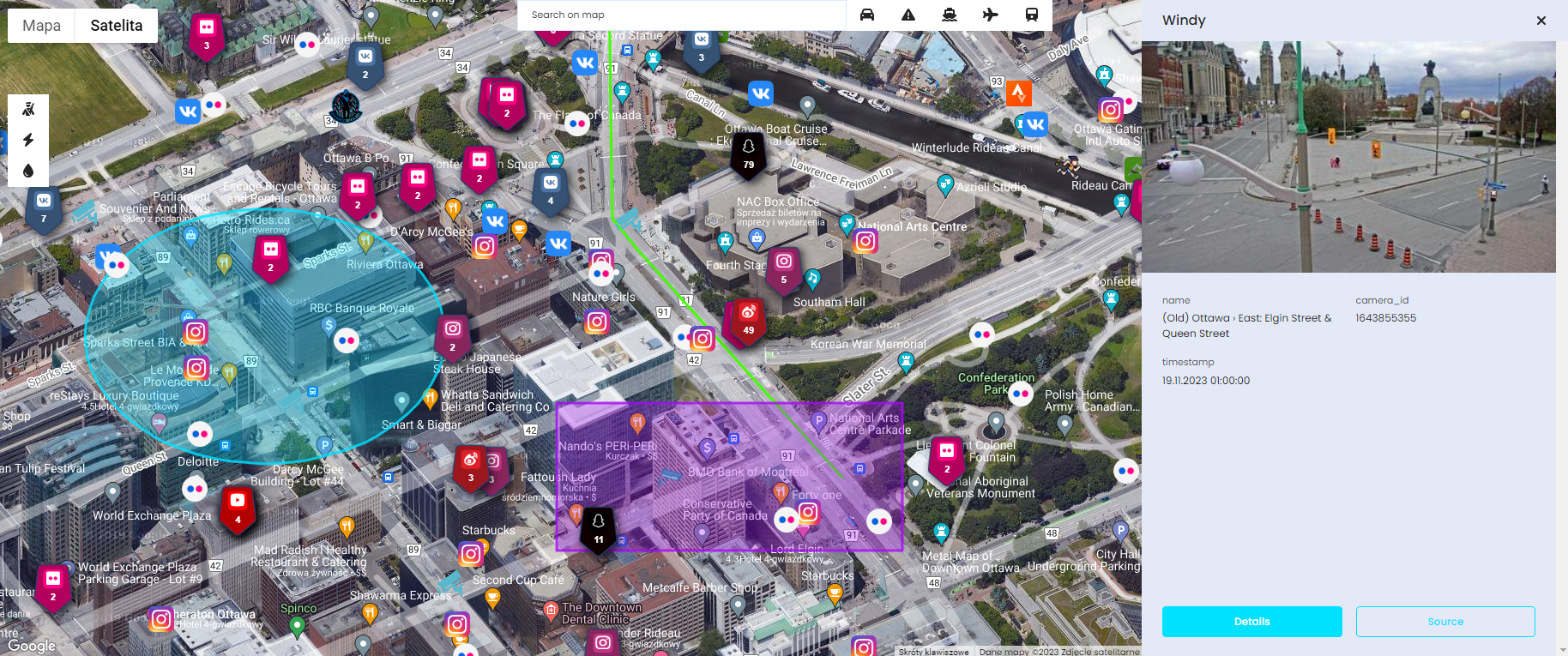
- Public Cameras
- Surveillance (R) - Overpass API
- Traffic (B) https://github.com/AidanWelch/OpenTrafficCamMap
- Windy (R)
- Worldcam (B)
- Shodan module (Exposed Cameras, IoT, ICS, Vulnerabilities, Screenshots) is displayed on map only for illustration purposes. It's IP based geolocation, so it's not accurate at all. Read more how to geolocate such devices on other articles on my blog (R)
- Wigle
- Wifi (R)
- Cell tower (R)
- Bluetooth (R)
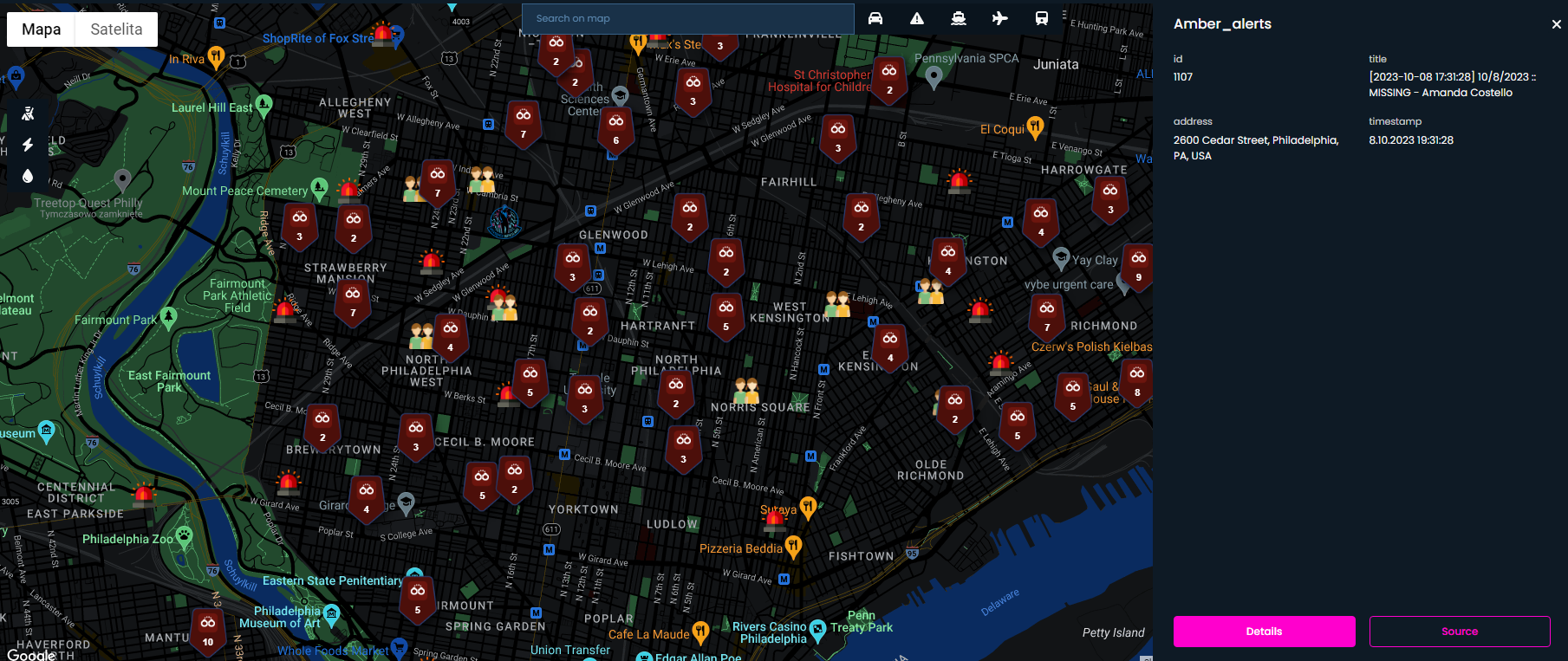
- Events
- Amber alerts (B)
- Crimes (R) - https://spotcrime.com/
- Transport
- Traffic (B) - Google maps
- Incidents (B) - Bing road incidents
- Vessels (B) - https://www.myshiptracking.com/
- Planes (B) - https://opensky-network.org/
- Trains (B) - Amtrak live trains map
- Critical infrastructure - Overpass API
- Military (B)
- Power (B)
- Water (B)
Summary
I hope after this quick summary everything is clear and nothing stops you to register on https://www.os-surveillance.io/ and start using application right now.
I can't guarantee that the price will remain constant, as it varies based on the number of modules included. Over time, the cost is likely to rise, particularly as I add more modules and features in the newest versions.
Moreover, I'm very confident this technology will allow to do location based investigation more efficiently and without missing any important item.
Soon, I will publish real world investigations and how tool can help in variety of cases, so stay tuned and follow me on Twitter