
Welcome in third article in Open Source Surveillance series, in today's episode we discuss traffic incidents, Amtrak Trains and how to track transportation system in real-time.
If you didn't read last article about cameras, public and Internet facing, I recommend you to do so from link below
 Wojciech
Updates
Like every time, I want to summarize what changes have been made since last update
- Platform has been listed on betalist.com so give it a like


- Added new Crime module
- Prepared Pitch Deck
- Amtrak trains and vessels
- Added traffic incidents
- Statistics & Map for module (implemented in Internet exposed cameras and Twitter so far)
- Add note to the finding
- Improved CSV import
- Changed Cloudflare rules and redirections
- Smaller GUI & backend improvements
Introduction
Real-time monitoring is crucial for ensuring safety of a city, tracking ongoing events, or protecting critical infrastructure against physical and cyber threats. Everyday, in big cities, some accidents happens - it might be related to vandalism, theft, shooting or other crimes, as well as traffic incidents.
In addition, it's possible to cross reference all of such events with variety of social media platforms by gathering post and photos from this territory. During any field operation, it's worth to add extra pair of eyes on the ground and search for any signs in social media, that might help individuals feel safe and give another support.
There are of course more than that, OSS supports many types of cameras and you can import CSV with your own source. Combing all of these methods give incredible results, it gives you access to the whole picture of investigated territory but also very detailed view, if you focus on one module.
Moreover, transportation system is very important to track what is currently going on in the city, and we will take a look on different sources and how to use them to make a real-time transportation tracking.
Transportation
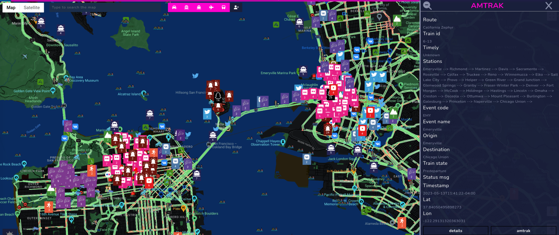
So far three transportation modules have been implemented in Open Source Surveillance and all of them are world wide - Vessels, Planes and Traffic. However, each country, state or city has their own public transport system, railways, taxis and other. For example, biggest railway company in US is Amtrak, and they offer real-time tracking of their trains
but for other countries, completely different source must be used, which is not doable at the moment due to large amount of the countries and theirs transportation services. Additional modules can be implemented per demand.
This new module uses above source to track real-time position of Amtrak trains
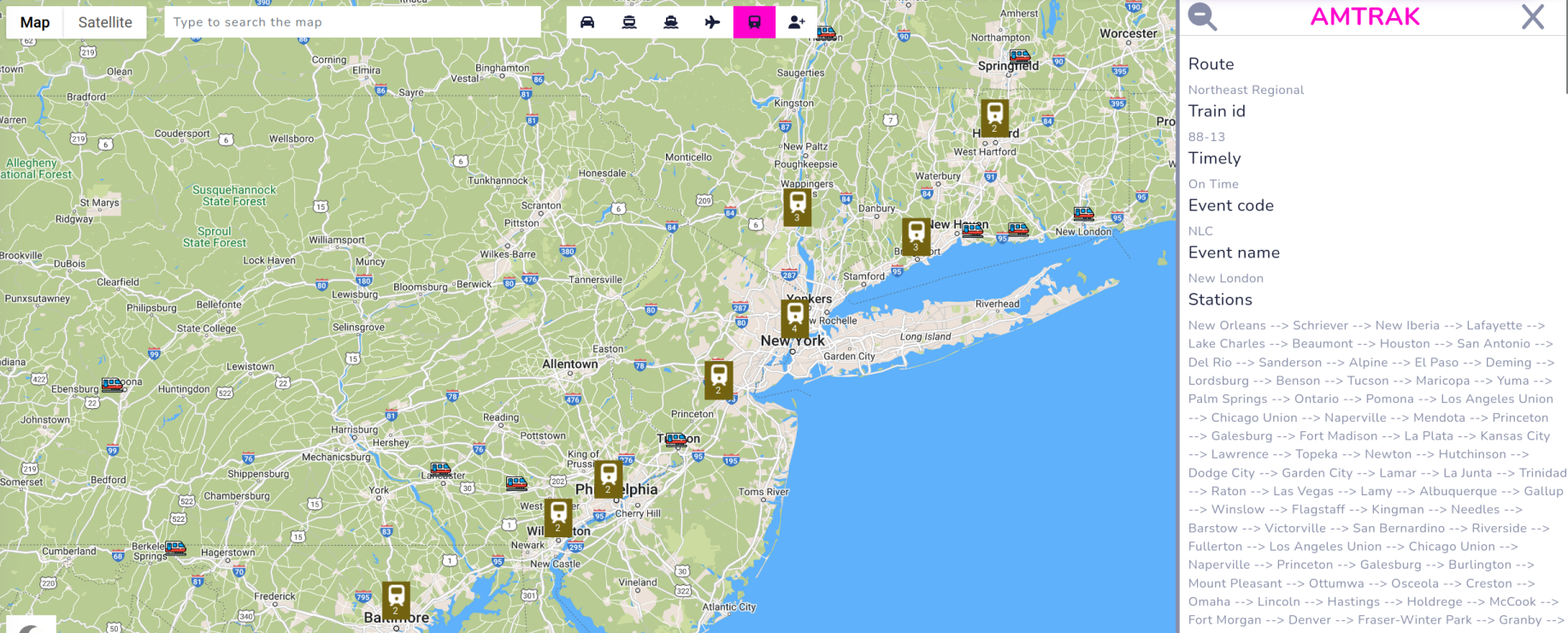
It shows route, stations and whether it runs according schedule.
There are plenty of advantages by real-time tracking, let's take hypothetical riots in big city as an example - having additional eyes on the sky by looking on aircrafts above the situation can help to coordinate movements, and make surveillance more effective. Social media modules can help to gather evidence on the ground and coordinate next actions.
Other modules like vessels, trains and road traffic might be used in their own way, depending on the situation and creativity.
Planes
Most popular OSINT tool to track flights is Flightradar, however due to some API limitation, platform so far uses OpenSky network, but I hope to improve it in near future.
I'm aware that Flightradar has a lot better coverage especially in terms of private and military aircrafts, what is the most important in OSS - cross reference with situation on the ground, so tracking helicopters or planes would absolutely fit here.
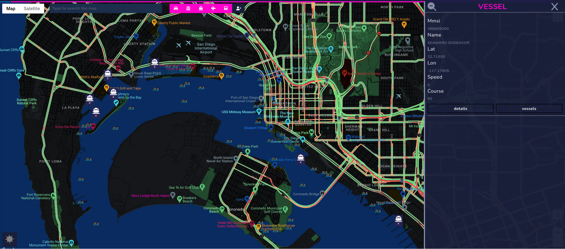
Vessels
It's another module that has been added recently and uses MyShipTracking to track variety of ship types, including tankers, cargo or passenger vessels.

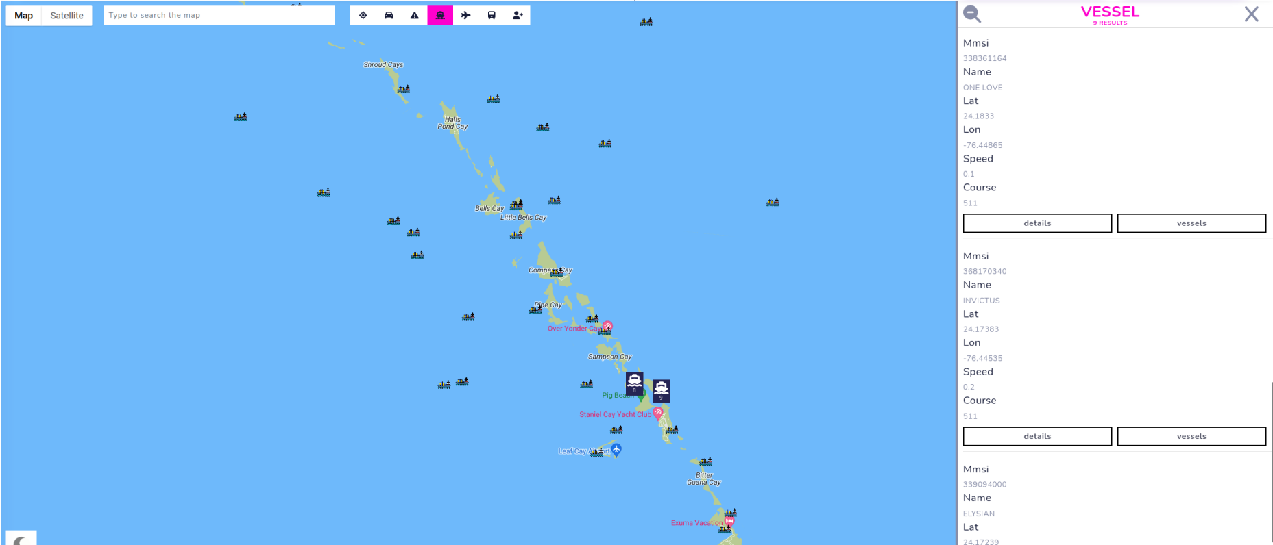
Due to lack of better and free sources, only basic information are being extracted and displayed, but if you click on "vessels" button, it will redirect you to marinetraffic.com website with detailed info about this particular ship.
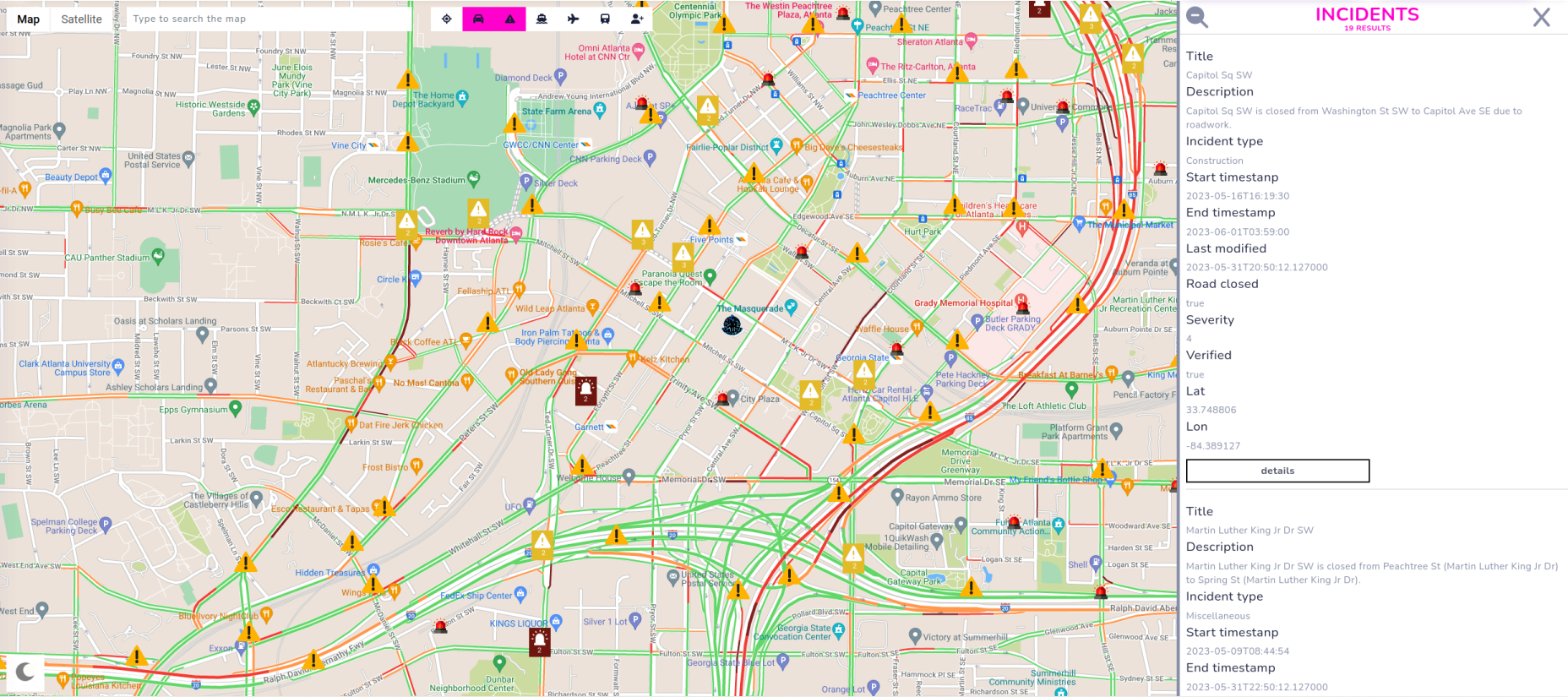
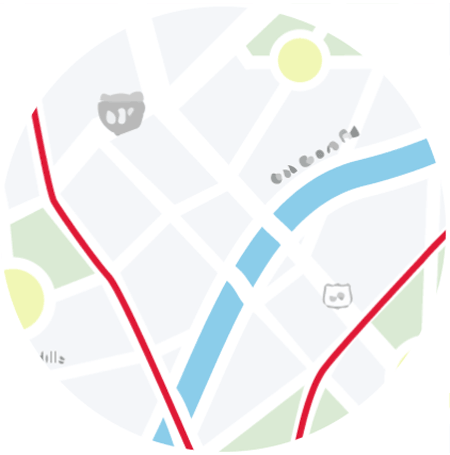
Traffic & Incidents
Probably most of you monitor road traffic when driving, and one of the best source to do that is Google Maps. This same technology is implemented currently in Open Source Surveillance. It shows what street is crowded and where is no traffic at all, you can confirm it with public cameras module.
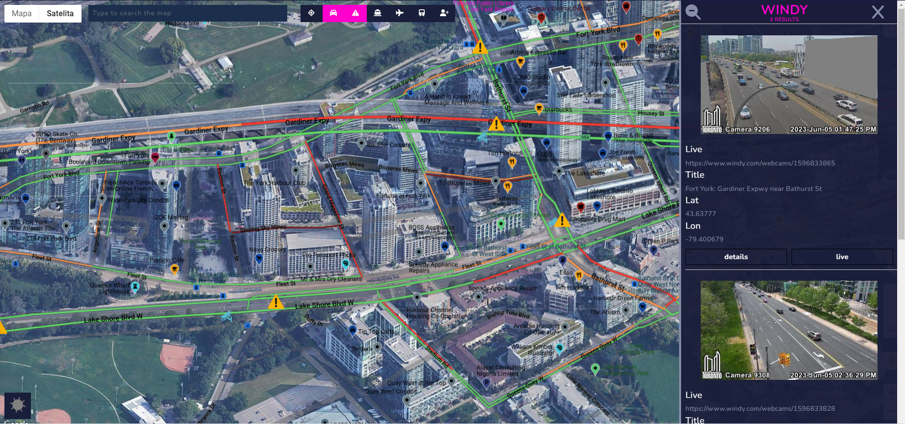
Incidents are taken from Bing Maps

and shows what happens on the roads in real-time including accidents, congestion, road hazard or constructions, every finding has also impact in scale 1-4. Whole list is available on official documentation
This is the five modules I can think of which are accessible to everyone via open sources to track live movements of objects in the city or whole country. Additional source for specific territory, can be implemented when necessary.
Beside transport, we can get another insight of how city lives, in real-time, thanks to particular events that are currently ongoing.
Events
This should be the "heart" of the system and everything should happen around it. When there is a concert or a big sports game, security services or police departments, responsible for safety of the event, should utilize OSINT as one of their "surveillance" method. It gives additional view on the field, i.e. you can get live footage from inside of the event you observe. It also refers to crimes, strikes or riots, OSS applies to ensure public safety in many cases.
Crimes
Almost each US state publish statistics about crimes and where they have occurred, best example is City of Long Beach, California.


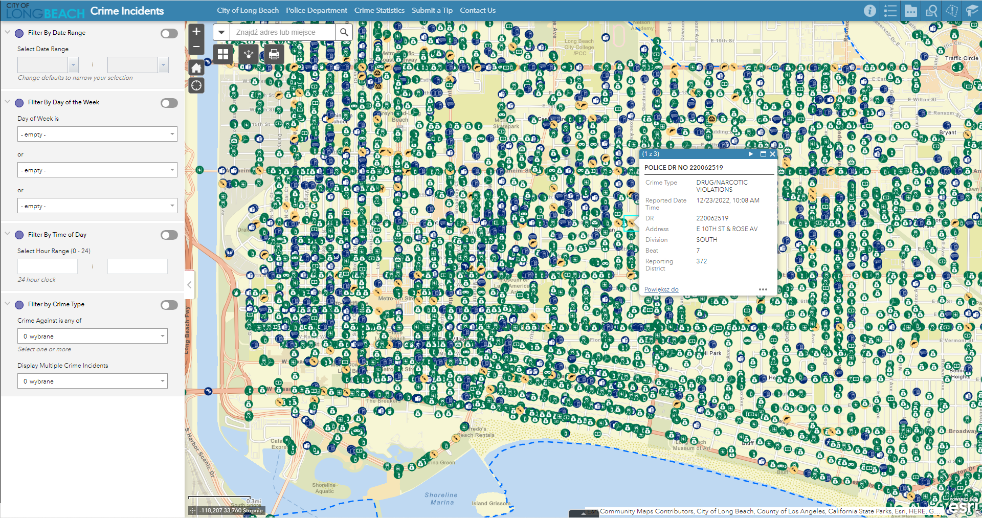
Crimes in Long Beach
That's a lot of data to digest, and majority of cities in US contain such information. Luckily, I didn't have to implement crawler for each place because spotcrime.com collects them all.

The first advantage, I can think of, when putting crimes on the map and cross reference it with social media posts is to look for witnesses. Someone could run, in remote place, couple minutes after crime has been committed and Strava module can detect this activity. It's the case with all social media modules, and sometimes people document their crimes, so it's easy win.
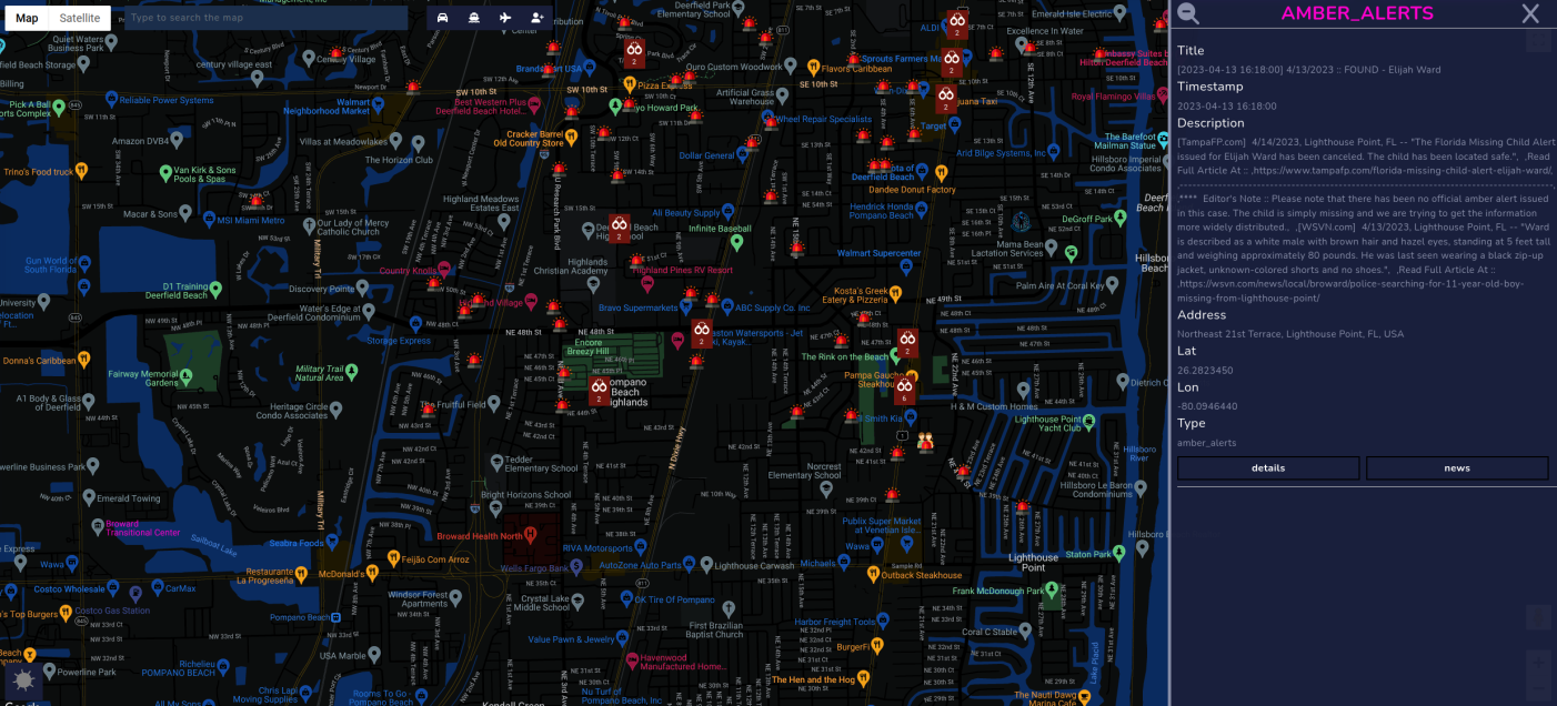
AMBER Alerts
AMBER Alert is a state-wide alert announced by law enforcement to help find abducted or missing children. You can read more details about it below.
 see reuse policy
Following criteria must be meet to issue AMBER Alert
- Law enforcement must confirm that an abduction has taken place.
- The child must be at risk of serious injury or death.
- There must be sufficient descriptive information of child, captor, or captor's vehicle to issue an alert.
- The child must be under 17 years of age.
The only one source I found that gather the alerts is
http://amberalerts.globalincidentmap.com/
however, servers behind it are not stable and do not work often, so I'm still looking for a better source that lists AMBER alerts and similar. Best fit would be of course

but paying $150 for 200 requests per day is not in my range so far.
Next steps
That was quick presentation of sources, newly added and already implemented, in the platform. A lot of improvements, in terms of events & transportation modules will be added. From frontend perspective, I want to make transport more interactive i.e. streaming requests and making planes, vessels and other objects moving in real-time according their position.