ꓘamerka has new cool features, right now you can search for Flickr and Instagram photos, printers and cameras from Shodan and Tweets (FIST). Everything is clearly presented in form of interactive map with icons and popups.
 woj-ciech
Introduction
My main target was to create something helpful to geolocate places from pieces of information and last project ( ꓘamerka) wasn’t so good as I expected so major changes were needed. Social media are mine for various information including pictures, people make photos of everything — streets, parks, government buildings and lot of them are not aware about possibility to include location to the photo. Of course there is also big part of tagged pictures on purpose, for advertising purposes or just simply to brag. These people can help even without noticing it, some photos may point to location you were looking for, maybe my skills in @quiztime will improve :)
Other usage:
- Gathering intelligence by observing specific territory (https://www.bellingcat.com/news/uk-and-europe/2018/11/06/open-source-monitoring-nato-trident-juncture-exercises/)
- See what’s going on in your city
- Confirming latest dump from Wikileaks — part 2
- Take virtual trip to any city
Flickr
Flickr is one of the platform for sharing pictures and it’s more about nice views and artistic frames.
100 latest photos are retrieved with accuracy=16 but it still shows photos far away, so radius parameter in this case does not work properly. However, geolocation is the most accurate from every other service, which screen below confirms.
root@kali:~/# python kamerka.py — lat 42.9708746 — lon -71.1272902 — flickr
Flickr API documentation — https://www.flickr.com/services/api/
I couldn’t register my application in official Instagram API, which then allows to search by coordinates, but I found another way with help of unofficial API, more details what to change and how to use it on github.
Process of finding photos in this API is not very accurate, first it looks for known venues and then display photo from this address.
First 5 newest photos of each venues are retrieved. In less crowded cities venues can be further than in given radius.
Remember last article and cameras near secret Amazon warehouse from Wikileaks dump? It turns out that there are couple interesting photos nearby.
root@kali:~/# python kamerka.py — lat xx,x — lon yy,y — instagram
Instagram API — https://github.com/LevPasha/Instagram-API-python
Shodan
Printers were added to the tool and same as camera — green icon means public access and red — response different than 200. Moreover, if camera contains screenshot, it will be also added to the popup.
root@kali:~/# python kamerka.py — lat 45.504 — lon -73.5747 — camera — printer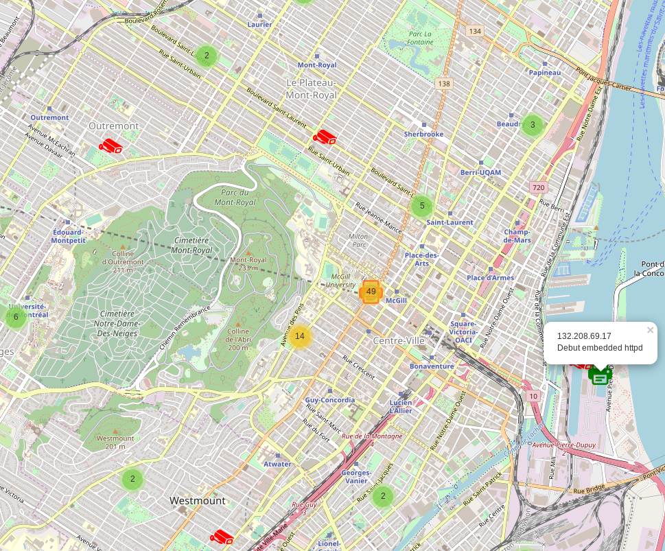
You need to have paid subscription to use Shodan module
Shodan API — https://developer.shodan.io/
Kudos for someone who will be able to find open camera pointing on open printer and record printing.
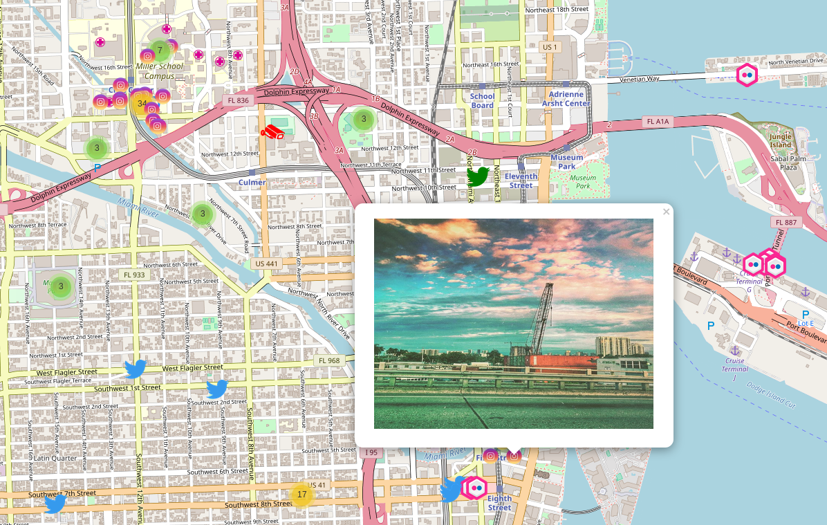
There are a few pictures with geolocation on Twitter but still I’ve wanted to have it in place, though. By gathering tweets on specific location you can track society moods or some big events and protests. It’s fun to watch what people tweet in what places. Unfortunately you cannot escape from ads, so there are couple advertisements tweets and job offers.
First 10 pages are searched and each page contain 100 possible geolocated tweets. If tweet has picture included, Twitter icon, on map, goes green. Tweets still could contain photos even if there is no picture in the popup. It’s because people add link to their Instagram photo so it’s worth to check full tweet, which link is at the end of every popup.
root@kali:~/# python kamerka.py — lat -35.2826088 — lon 149.1231722 — twitter
Twitter API — https://dev.twitter.com/overview/documentation
Everything combined
At first sight it seems very blurry and messy but everything is interactive so if you zoom to specific point it becomes easily readable and you will have lot of fun playing with this.
It’s recommended to open pictures in new window for better visibility.

Conclusion
This tool creates a lot of opportunities for intelligence and geolocation purposes and at the same time giving you lot of joy. I tried to anonymize everything, so there is no usernames nor timestamps, because it’s more about places and things and not people. Of course I had no time to explore every city in the Earth but I strongly encourage you to take a look and try to find something cool.
Originally published on November 29th, 2018
 Wojciech