
I'm happy to introduce Open Street Map capabilities into Open Source Surveillance, free for all users. Now, it's easier than ever to geolocate any image, and especially supported by other feature - AI Geolocation.
First things first, Cody (https://twitter.com/tucketmaster) made a video review of the Open Source Surveillance and it's a perfect tutorial for everyone who want to see platform in action.
Register on
New update provides search for points of interest & places & objects near other OSM features. Dive into this article for a tutorial and practical examples on how to make the most of this exciting update.
Video shows how to quickly find subway stations near waste baskets and benches within distance of 50 metres.
Introduction
Open Source Surveillance is not only real-time situational awareness system but since last month, I've added new features to support geolocation investigation. Any analysts/researcher should take advantage of newest technologies to save time, try new approach or extend his OSINT arsenal. That's where Open Street Map and Overpass Turbo API come to play.
OpenStreetMap provides a rich, community-driven map data repository that offers detailed and up-to-date geospatial information. By integrating OSM into the XD system, analysts can leverage a vast database of geographic data that includes everything from road networks and building footprints to natural features and points of interest.
Open Street Map & Overpass Turbo
OSS already uses Overpass API to find critical infrastructure objects and surveillance cameras with query like this
[out:json][bbox:{{bbox}}];

(
  node["man_made"="surveillance"];
);
out body;
>;
out skel qt;
Each objects or building has it's own OSM feature. You can find whole list here
Thanks to this, we can have a better navigation knowing exact position of bus stops, cinemas, fountains, surveillance cameras and many more.
One of the OSM capability is to search objects nearby other given place. Let's say you need to find all cinemas within 500 metres from swimming pools, and to achieve that we use "around" filter.
[out:json][bbox:{{bbox}}];

node["leisure"="swimming_pool"]->.place0;
(
    node(around.place0:500)["amenity"="cinema"]->.place1;
);
node.place1;
out;
If you copy paste above snippet into https://overpass-turbo.eu/, it will show you the results, i.e. cinemas near swimming pool.
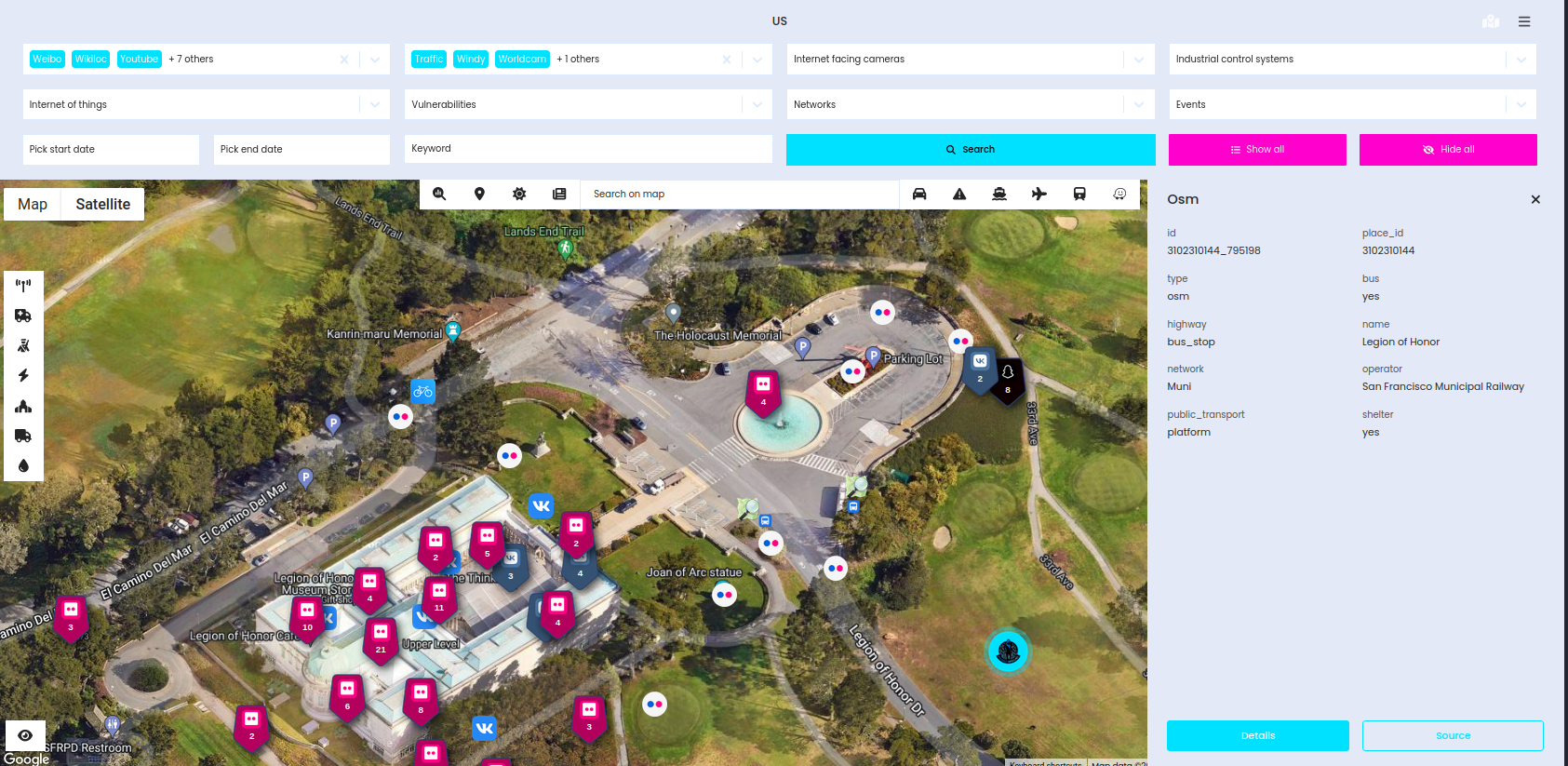
There are hundreds of potential OSM features and remembering all filters is not possible, that's why I implemented user friendly interface, where you just choose objects and Open Source Surveillance will find it for you.
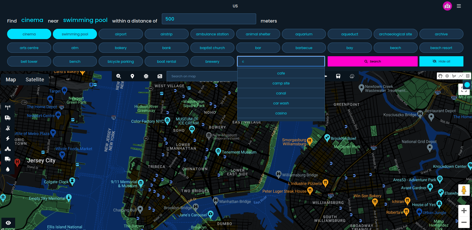
To display OSM panel, you need to click at the right top corner and all options will be accessible. Next, just click on the features that you want to find, and set distance. After that, click search and your results will be displayed. Remember to click first on the place you want to search and next ones will be places nearby.
Important
- Free for all after registration
- Results are not stored in database and can't be retrieved later.
- Search might take some time, especially if you choose large place, and timeout is set for 30 seconds. If you will have an error, please zoom in and search again.
- If you need more OSM features, let me know and I will add it.
- Search returns 200 items maximum, if there is more app returns error, please narrow down your search.
- Try to be as detailed as possible to find exact location.
- You need to pick at least 2 features and 4 maximum.
- Before every new search, click "Hide all" to delete current OSM markers & clusters
- Please report any bugs, issues and feedback on Discord or via email
Tutorial
Let's take a look on some examples how Open Street Map search can help you to geolocate some photos.
Bus station & fountain
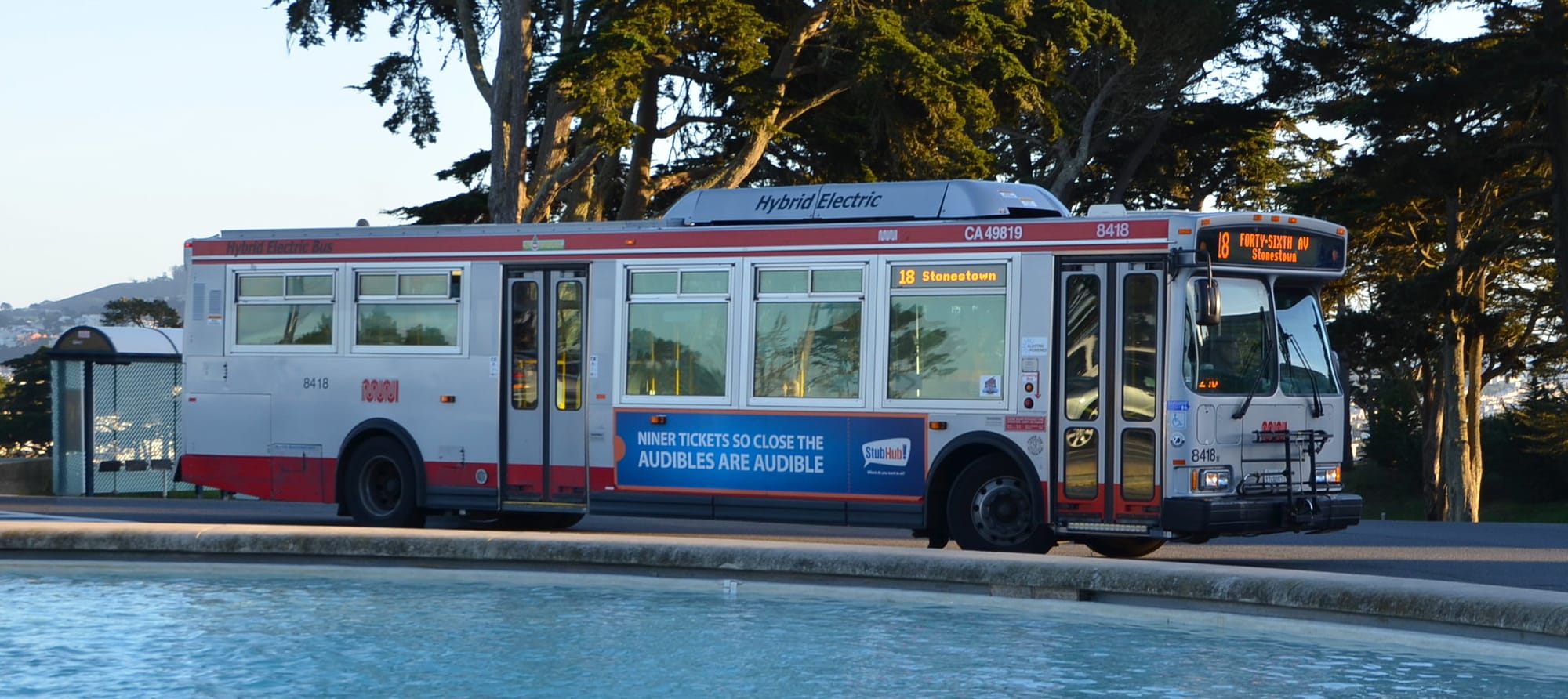
This one is quite easy, since we can quickly narrow to the country - United States, and city - Stonestown. First idea would be to check the path of the bus 18 and follow the road to find exact place where this photo was taken, however we can get different approach and look for distinctive objects on the photo. On the first plan we see fountain, and bus stop in the background.
To search for all fountains near bus stops, we select these features and put ~100 metres as distance.
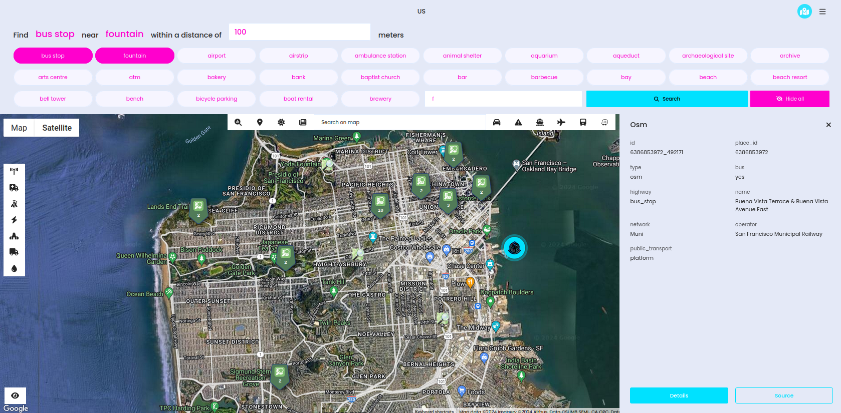
After couple seconds, we have results and they must be reviewed manually and compared satellite/street view images with actual photo. Also, based on the background we know it's not in city centre but rather in the park.
Quick research and we have the location, OSM successfully found this bus stop and we can see fountain as well.
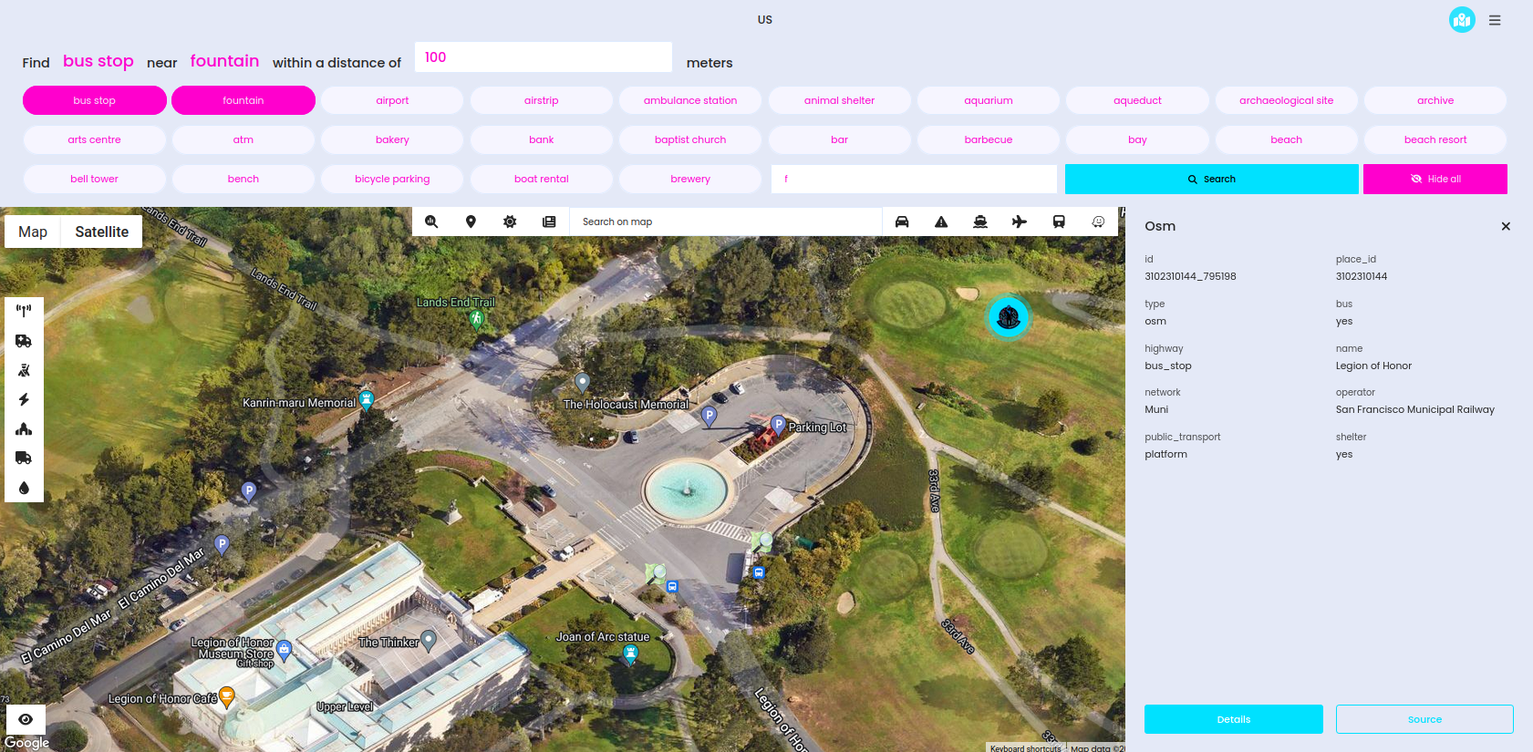
Also, don't forget to run proper modules to obtain more photos & information about the place and confirm or deny our geolocation assumptions.
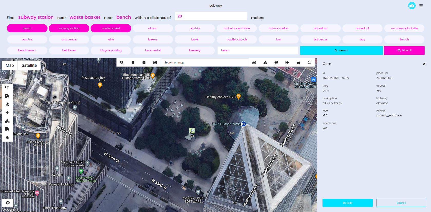
Subway station & trash bin & bench
This one is quite harder since it's tough to establish city at the first sight. Probably, lot of people already recognize it based on the architecture, but if you can't no worries - AI geolocation comes handy here.
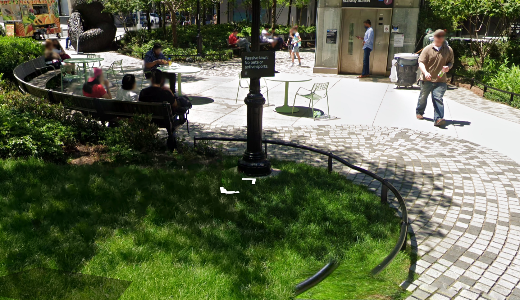
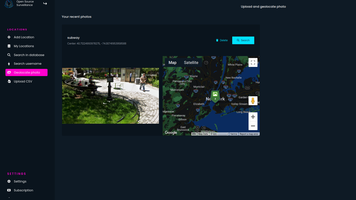
Just drag & drop photo into OSS upload page and you will get potential locations. It's not precise but can narrow your search to specific country or city and then you can use other tricks to find the place.
Of course, you can use google lens, cut some part of the image like the pole with announcement, to potentially find where it's used.
AI geolocation feature shows New York as a possible place where this photo might have been taken. We don't want to waste time to check each subway station in park, so it's good to find particular features, that we want to use in the OSM search.
Except subway station, we can see benches and trash bin, so it's enough to click on these three items. If you can't find it on main screen, start typing in the form and rest of the objects appear.
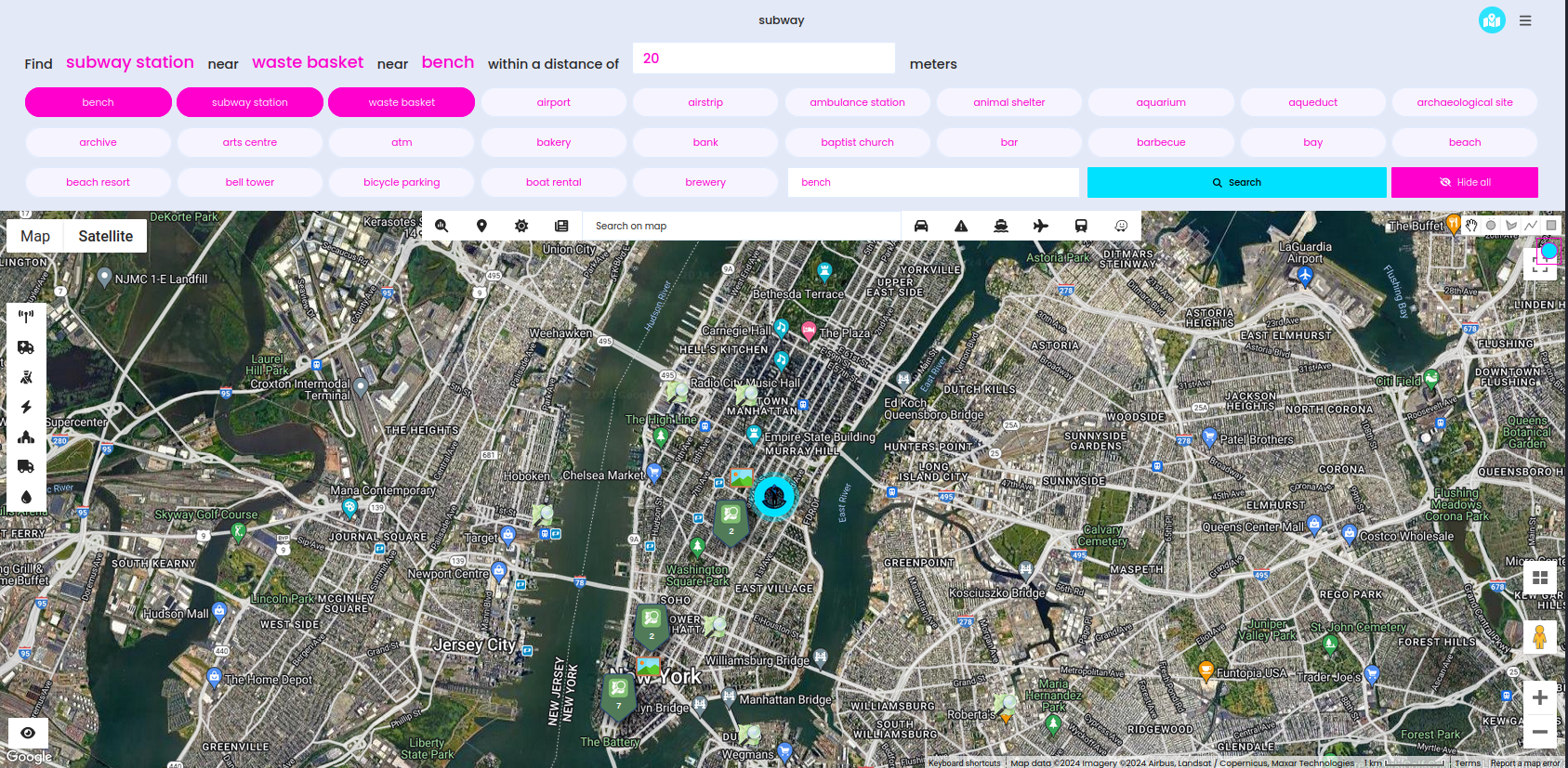
There are actually couple places like that but we can quickly find the exact place.
Summary
Open Source Surveillance system, a real-time situational awareness platform, has recently been enhanced with new geolocation investigation features. Integrating OpenStreetMap (OSM) and the Overpass Turbo API, OSS now provides detailed and up-to-date geographic data, allowing analysts and researchers to conduct precise and efficient geolocation investigations.