
This update is one of the most important one, from analytic as well as research standpoint. Right now you can analyse specific territory and get statistics and timeline about it. This feature is extremely useful for tracking events in the designated area on a daily and hourly basis.
Register on

To get familiar more with the tool, read previous articles
 Wojciech
 Wojciech
This post provides extensive tutorial how to use Analyse Territory feature and how to get max out of it and utilize in your investigation.
TerritorialDispute
The project's codename was inspired from Vault 7 leak where CIA had to state presence of other state nation actors in already compromised, by them, workstations. This concept metaphorically refers to the convergence of numerous individuals, actions, and activities within a single location, with the objective of identifying significant ones.
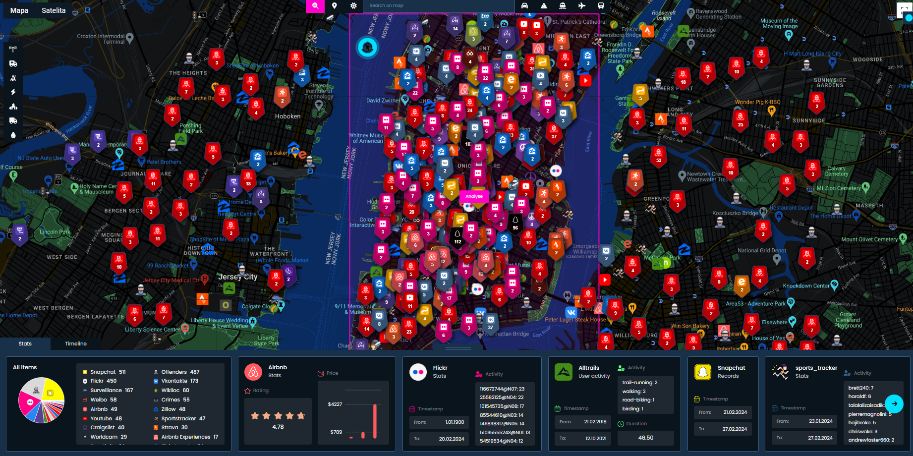
Personally, I like very much design, colours, charts and the information that are displayed for statistics. It's clearly visible what happened, who posted it and when.
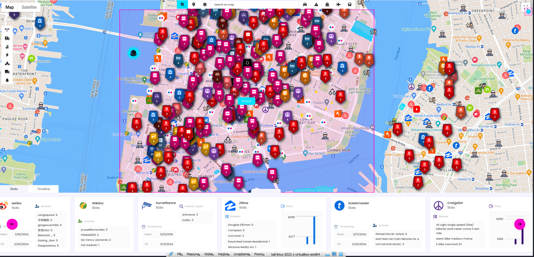
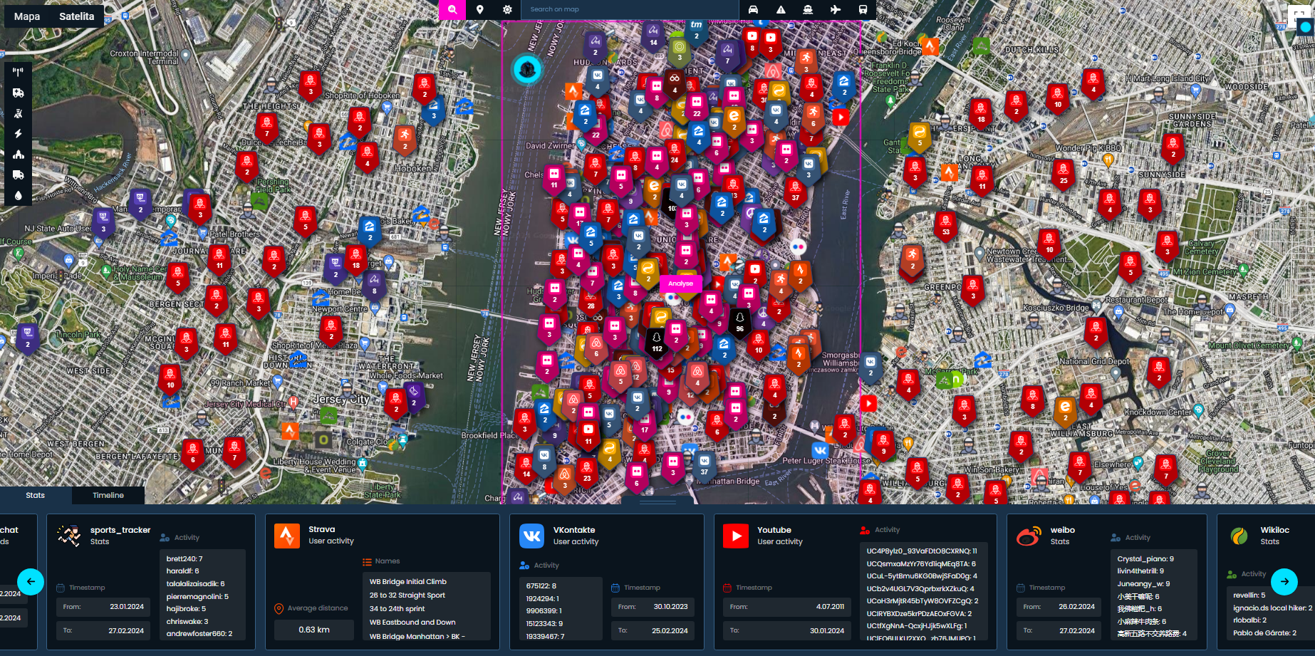
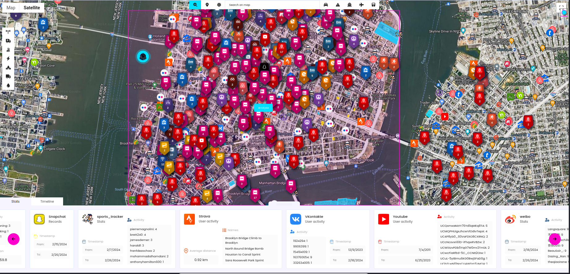
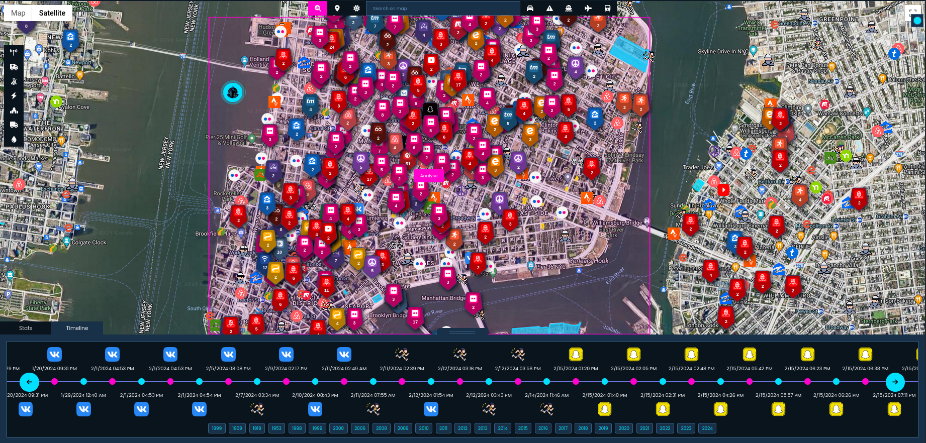
First part is, as always, to run modules against specific territory (now you have more than 30 to choose from) and wait for the results. It's worth to scan multiple times, putting marker in a different places, but if you follow the tutorials, you should already know that.
At the top and left hand side from Map Search input, there is a new button called Analyse, and when clicked, it changes to rectangle you must put on the map to mark the territory.
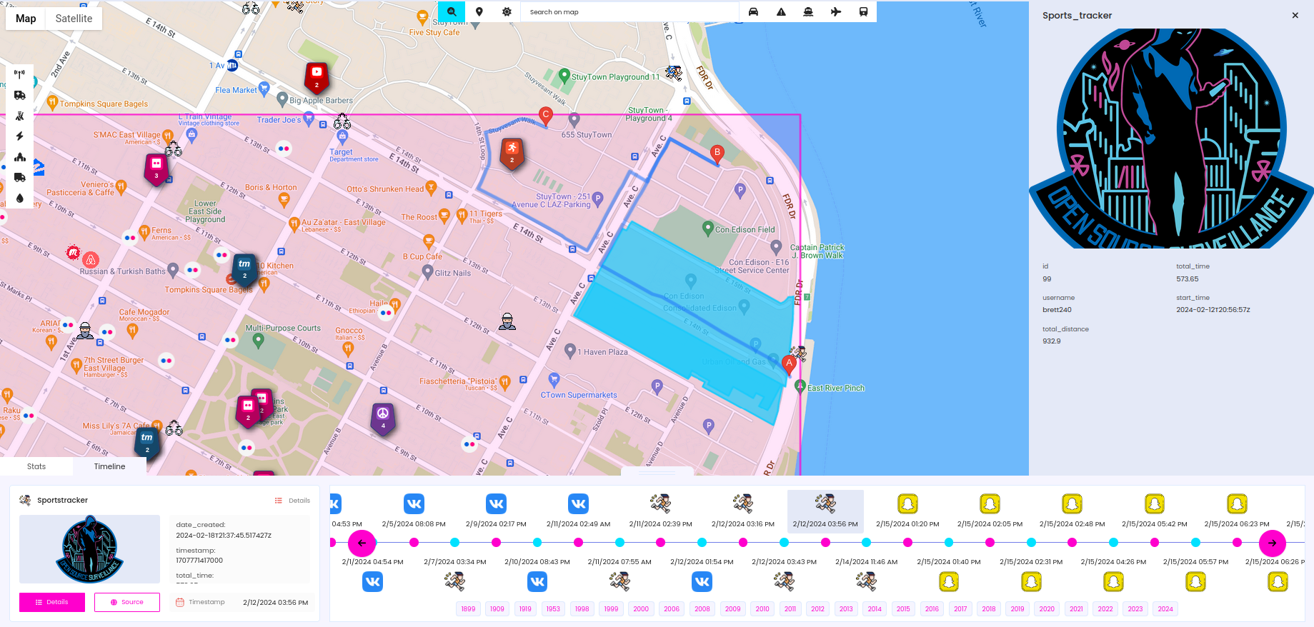
Application takes all findings that are inside the rectangle, analyses it and makes statistics to display it on the bar at the bottom. First tile in statistics gives overview of all found items and rest are divided by module. Due to differences in data, statistics are quite different for each module, but in general you have access to timestamp (oldest and newest finding), activity (user and amount of activities), price range and just list of names, like for Strava (segments), Events or Critical Infrastructure amongst others.
Cool addition, is when you click the timestamp it will move the map to the corresponding marker, so it's super easy to find first and last item from each module. With this in mind, we can move to next part of the TerritorialDispute which is Timeline.
Timeline
Timeline is a critical component of the entire system. It is now feasible to examine all discoveries chronologically, thanks to a well-organized timeline dashboard. I am genuinely pleased with its functionality, appearance, and the significant value it adds to the application
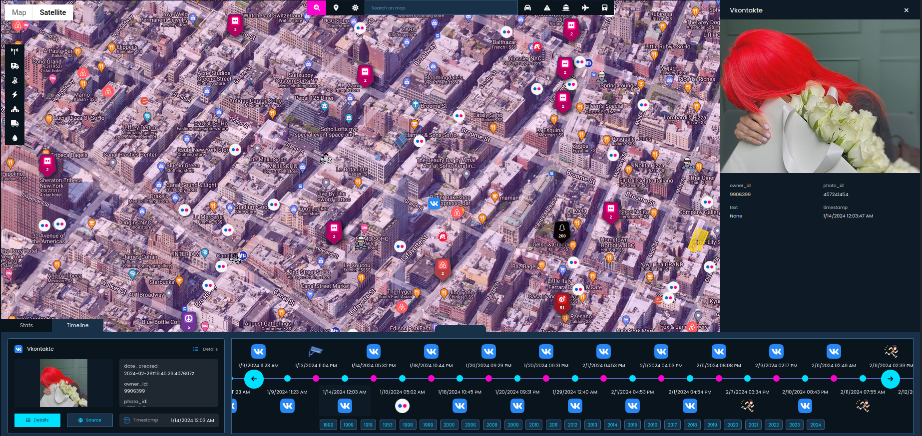
If you haven't noticed yet, there are two bookmarks on the bottom bar, and Timeline looks like on screenshots above.
It's organized by year, allowing for quick navigation to the desired period for a more detailed examination. Selecting any item on the Timeline will display information in the bottom left corner and automatically adjust the map to the relevant marker. This feature is straightforward, user-friendly, and accelerates investigations, whether they concern historical events or current events.
It works smooth even with 1000+ items, with more than 2k items, it uses more memory but the user experience is still good.
Summary
I hope this quick, however instructive article presents you how important Statistics and Timeline are in terms of territory investigation and how to use them in OSS. Stats gives you quick overview over the researched place and Timeline comes into play when you need to establish order of the events. Of course, it includes usernames or IDs of the people engaged in any activity on the place you research. All of these features make Open Source Surveillance a unique and necessary tool for every person interested in Geospatial and Open Source Intelligence investigations.